Subscribe now for unlimited access.
$0/
(min cost $0)
or signup to continue reading
A bitter row over how to map NSW's precious natural habitat has split the state's environment ministry, prompting accusations of millions of dollars wasted, opaque funding processes and the cover-up of a damning internal report.
The dispute, which has festered for years, centres on the introduction of an automated mapping system that uses pattern-recognition technology to identify the location of the state's 1500 types of plant communities – some of them endangered.
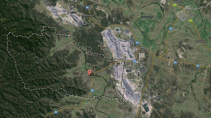
A peer-reviewed paper published this month by John Hunter, an ecologist and lecturer at the University of NSW, found the modelled mapping based on satellite imagery had an accuracy of just 17 per cent in determining individual communities in the upper Hunter Valley.
"The results of this validation suggest [the method] is of such a low-level of accuracy within the upper Hunter as to be inherently unusable for broad-scale regional and local landscape planning or environmental assessment," the paper said.
Office of Environment and Heritage officials, though, defend the $10-million program, saying they are redoing the Hunter region using better aerial imagery.
They say their program is not intended for regulatory purposes, which require an accredited ecologist to sign off on.
Pointing to their own testing of mapping in the Namoi region, OEH officials say their charts were 53 per cent correct for single plant communities. Accuracy rose to as high as 93 per cent when differentiating between woody and non-woody landscapes.
"You learn as you go," Jeremy Black, head of the native vegetation information directorate, said. "It's manual where it needs to be and it's automated when it can be."
Environmental groups and ecologists, though, remain concerned that the method – known as segmentation mapping – has already been used in plotting vegetation likely to be destroyed by new coal mines.
A handpicked scientific committee set up by OEH is only vetting the process, not the results, they say.
"They don't comment or check the results – only the ways and means that the process of modelling is done correctly," Dr Hunter said. "The process may be 100 per cent scientific but the model that is produced may be 1 percent accurate and the process used will still be a valid process."
Conservationists also worry the mapping will underpin the Baird government's new biodiversity law to be introduced this year, which will allow greater self-assessment by farmers and other landholders seeking to clear land even if endangered species are present.
The program's "going full bore ahead", Oisin Sweeney, science officer of the National Parks Association, said. "At some time in the future, someone will say 'we've got these great maps, why can't use them?'"
The past four years are littered with episodes of revolt by disgruntled OEH insiders and intended end-users of the maps, such as the Hunter Councils, which funded Dr Hunter's review.
"The SPOT5 [satellite] segmentation program should cease," John Benson, an senior ecologist then with the Royal Botanic Gardens and now retired, told a two-day OEH workshop "Towards Best Practice" in November 2011. "It has not been subject to enough independent assessment yet it continues to be funded at the cost of other important projects."
The OEH science division, which runs the mapping program, failed to inform other attendees at the workshop it was about to seek $4.5 million in extra funding from the Environmental Trust late the following month.
"This oversight [by the science unit] further escalated tensions between other OEH groups/divisions and significantly eroded trust," according to an internal report ordered by a OEH executive in August 2011 but then cancelled prior to its formal completion.
Fairfax Media has obtained a copy of the "Observations Report" compiled by Nicole Campbell, then on secondment from Premier Barry O'Farrell's department.
The report called for "an independent and comprehensive review" of the mapping technology, and recommended it be removed from the science unit's control.
OEH later denied a freedom of information inquiry by the Greens that any such report existed.
It is understood, however, that copies were sent to OEH executives.
"It is scandalous that the government did not release the Bio-Focus report when the Greens formally requested it back in 2012," Mehreen Faruqi, NSW Greens' environment spokesperson, said. "This makes a mockery of the whole freedom of information process."
"The Biofocus report shows that the NSW government ignored the concerns of its own experts, including the [EPA] and the Royal Botanic Gardens Trust, that it was spending millions of dollars on a mapping system wasn't accurate," she said. "No wonder they wanted to hide their bad decisions from the public to avoid criticism."
Fairfax Media sent a copy of the report to current minister Mark Speakman and sought comment.

